Viana do Castelo Municipality (Viana do Castelo)
 |
 |
Human settlement in the region of Viana began during the Mesolithic era, from discoveries and archaeological excavations. Even around the Roman occupation the area was settled along the Mount of Santa Luzia.
The settlement of Viana da Foz do Lima, which it was called when King Afonso III of Portugal issued a foral (charter) on 18 July 1258, was a formalization of the 1253 Viana that the area was named.
In the 16th century, its port gained great importance as one of the entry-points for Portuguese explorers and traders, involved in the Portuguese discoveries. Many of the historical buildings originated during this period.
The prosperity that continued developed from the town's role as a port, protected by defensive structures (such as the Tower of Roqueta) to repel pirates from Galicia and north Africa. The port's ties to northern Europe came primarily from exports of wine, fruits and salt, and imports of tile, textiles and glass.
After the maritime discoveries and trade, the commercial life of Viana reached its greatest proportions during the reign of Queen Maria II of Portugal, when the monarch established the Associação Comercial de Viana do Castelo in 1852 (the fourth oldest public company of its type). The queen, in order to reward the loyalty of its citizens, who did not surrender to the Count of Antas, elevated the town to the status of city on 20 January 1848, renaming the settlement with its current name.
Map - Viana do Castelo Municipality (Viana do Castelo)
Map
Country - Portugal
 |
 |
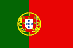
| Flag of Portugal | |
One of the oldest countries in Europe, its territory has been continuously settled, invaded and fought over since prehistoric times. The territory was first inhabited by pre-Roman and Celtic peoples who had contact with Phoenicians, ancient Greeks and Carthaginians. It was later ruled by the Romans, followed by the invasions of Germanic peoples and the Islamic invasion by the Moors, whose rule was eventually expelled during the Reconquista. Founded first as a county of the Kingdom of León in 868, gained its independence as the Kingdom of Portugal with the Treaty of Zamora in 1143.
Currency / Language
| ISO | Currency | Symbol | Significant figures |
|---|---|---|---|
| EUR | Euro | € | 2 |
| ISO | Language |
|---|---|
| PT | Portuguese language |


